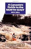
A canoeist's guide to the North-East : Scottish Borders, Northumberland, Co. Durham, Yorkshire Dales and the Coast / by Nick Doll
Material type: TextPublication details: Milnthorpe : Cicerone Press, c1991Description: 264 p. : ill. (some col.), maps ; 18 cmISBN: 1852840668Subject(s): Canoes and Canoeing -- Great Britain | Great Britain -- Travel and Description, 1971-DDC classification: 910.202
 | Item type | Current library | Call number | Status | Date due | Barcode | Item holds |
|---|---|---|---|---|---|---|
|
|
Central Library, Sikkim University General Book Section | 910.202 DOL/A (Browse shelf(Opens below)) | Available | P08471 |
Foreword Map of the area Introduction Using the guide (terminology and grading) Learning to canoe Access The Rivers- Northumberland Region (Borders to Co Durham): Allen; Aln; Balder; Blyth; Breamish; Coquet; Derwent (Co Durham); Devil's Water; Ettrick; Greta; Jed; Rede; Tees; Teviot; Till; Tweed; Tyne; Wansbeck; Wear; Whiteadder; Wooler Water -- The Rivers Yorkshire Region: Aire; Calder; Derwent (Yorkshire); Esk; Nidd; Swale; Ure; Washburn; Wharfe -- Flat Water Areas in the North East: Bolam, Hemlington, Kielder, Killingworth, Ladyburn, Queen Elizabeth II Jubilee, Scaling Dam, Selset -- Sea Canoeing: Introduction; Safety at sea; Planning and equipment; Basics of Tidal Theory -- Coastline of Northumberland: Tynemouth to Newbiggin; Druridge Bay (Cresswell to Hauxley); Amble to Beadnell; Seahouses, Bamburgh; Farne Islands; Holy Island; Berwick to St Abbs -- Coastline south of the River Tyne to Flamborough Head: South Shields to Roker; Sunderland to Ryhope; Seaham to Middleton; Hartlepool and Tees bay; Redcar, Saltburn and Whitby; Saltwick Nab to Scalby Ness; Scarborough to Flamborough Head -- Appendices: Regional Access Officers; Canoeing clubs and organisations; Outdoor centres North East with an interest in canoeing; Manufacturers and retailers of canoes and accessories; The Coastguard Fishing seasons; Tidal constants. H.W. times relative to R. Tyne entrance; Bibliography


There are no comments on this title.